
RURAL MAPPING & IMAGERY (2 and 3D)
0.5 to 1,000Ha+
Using Drone and satellite imagery combined with RTK and GIS software, Agriviews Ltd produces pinpoint accurate maps and imagery of your property showing any information you want from simple paddock boundaries to comprehensive land classification.
Aerial Mapping
Development Mapping
Slope Mapping
Satellite v.s Drone Imagery
We can Produce both Satellite and Drone Maps of your Property

Farm maps can help you with:
Farm development
Health and safety plans
Farm conversions
Land and environmental plans
Calculating effective grazing area
Property soil maps by- Utilizing the Landcare research soil map data
Helping manage tasks such as:
Estimating income & expenses per hectare
Make cost-effective decisions
Manage your land efficiently
Identify hazards
Estimating fencing/development budgets
Directing contractors, staff and visitors on site
Communicating with your rural banker & farm advisor
Our customized precision mapping can show:
Paddock names / numbers
Troughs
Hazards
Buildings
Farm tracks
Slope indications (winter grazing guides)
And anything else you can think of just ask
Map Samples:
-

Colour Farm Maps (Satellite)
Each layer is presented in the legend, your map will show as many layers as you request or multiply maps can be supplied to suit any requirement.
-

-

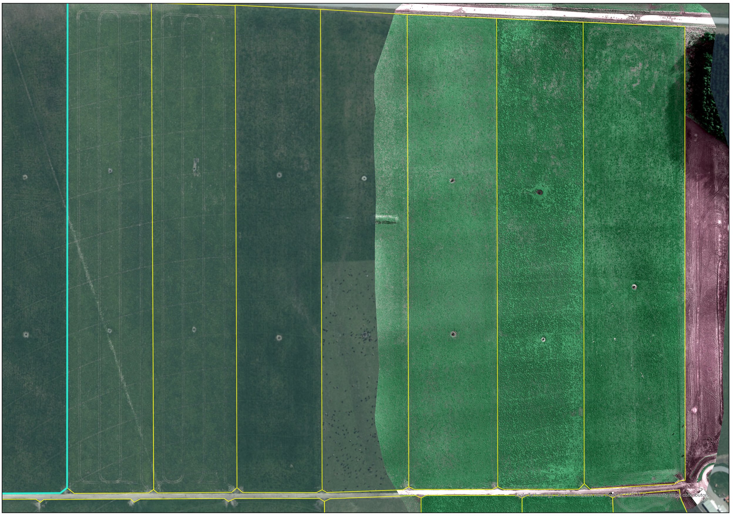
Basic Farm Maps
Suitable for workers, contractors, and visitors to the farm.
-


Development
Converting or redeveloping a farm is a major capital investment, working with yourself or along side a consultant of your choice (we can recommend one if needed) in Canterbury we aim to help improve your properties performance and efficiency by introducing changes such as irrigation designs to suit the property along with paddock and track layouts to future proof the property as well as saving time with stock moves.

We can help with any type of conversion or development you might have in mind, from a lane relocation through to complete reconstruction of a portion or /all of your property.
Dairy (sheep or cow) (Halter)
Dry stock
Feed Barns
Crop
Mixed Operations
Any other comprehensive conversions you may have in mind

Using GIS Software and Drones we can identify -Slope, Elevation and Direction
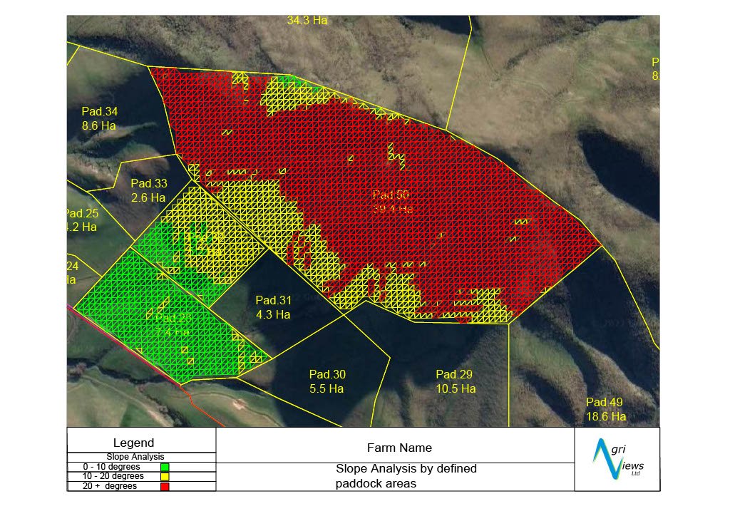
Slope measurements of individual paddocks or the whole property allows you to:-
Calculate areas for meeting rules such as the Intensive Winter Grazing (IWG)
Help apply for Resource Consents
Help develop Freshwater Farm Plans
Cost effective basic maps with no ongoing fees, these maps are with you for life!
Just print the PDF as many times as you like, or upload your digital file to google earth.
And if you misplace it just give us a call or email and we'll send you another copy